When it comes to choosing the right geospatial data for any project, many factors come into play—cost, convenience, consistency, and resolution, to name a few. Depending on the application, these factors can outweigh one another in importance.
Above all, one critical factor to never overlook is accuracy. Data accuracy is the degree to which information on a map matches real-world values. When it comes to geographic information systems (GIS) and artificial intelligence (AI) applications, positional accuracy plays a vital role in the precision of the mapped assets or derived vector data. Even with the most up-to-date imagery and highest resolutions, low accuracy can cause your project costly, time-consuming errors that threaten its success.
What does highly accurate imagery look like?
Geospatial imagery must be accurately referenced to its position in the real world to be useful. To achieve this, a network of ground control points (GCP) is needed to accurately map the imagery with ground coordinates and its relative position on Earth.
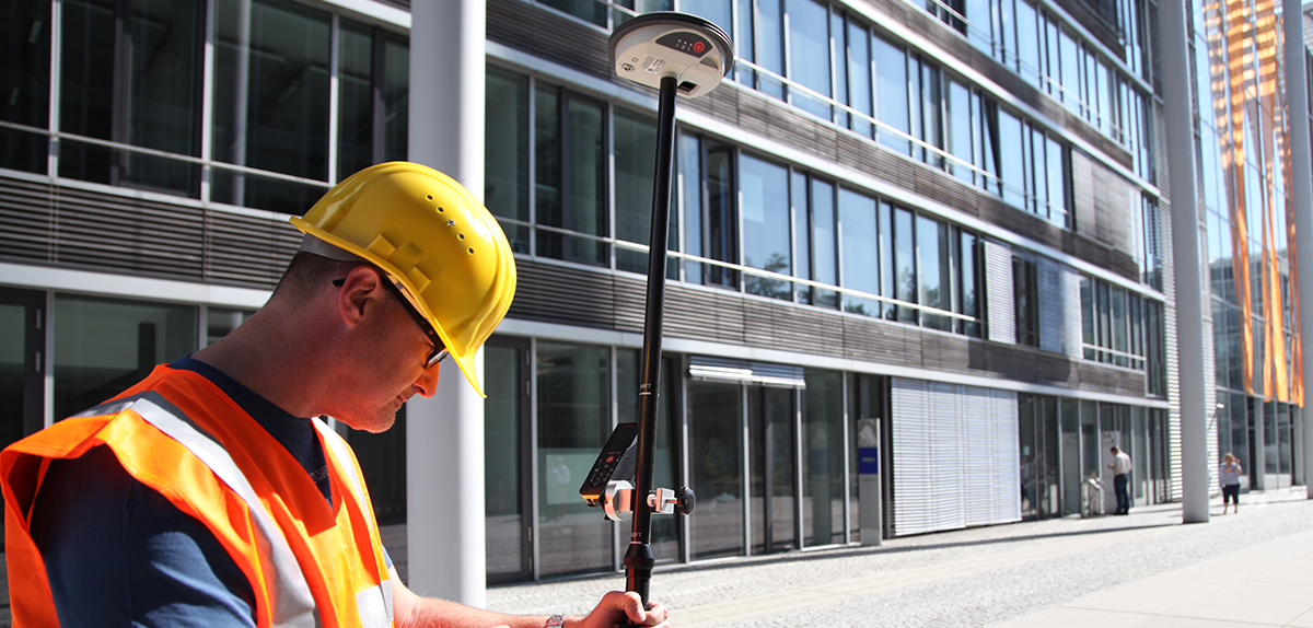 Surveyor using GNSS antenna to collect a GCP
By recording precise coordinates of photo-identifiable locations within an image, these coordinates form the basis to remap the image using processing software into geospatially accurate maps. An image may be several meters off if onboard positioning is used without any GCPs. Once ground control is applied, the accuracy can be improved by two to four times better than the uncontrolled native accuracy, allowing users to maximise the value of an image ground sample distance (GSD).
Reliable GCPs are the essential input for precise orthorectification of aerial data and are the most critical factor to an accurate foundation. GCPs are typically collected using GNSS-enabled equipment with survey-grade capabilities to verify the XYZ coordinates and position in relation to the image-identifiable elements around it. With the use of GCPs, aerial imagery data’s accuracy and consistency can be dramatically improved, leading to better results for applications from GIS analysis to AI and machine learning.
In addition to using GCP networks, the imagery must be orthorectified to correct distortions from the sensors, such as the angle at which the imagery was taken or the terrain relief, to create planimetrically precise images. The resulting orthorectified photos have a constant scale in which features are represented in their ‘true’ positions, allowing for the measurement of distances, angles, and areas inside the image. Orthorectified images are commonly used in visualisation tools.
High-accuracy, artefact-free aerial imagery on demand
Hexagon leverages the world’s largest network of GCPs with more than 65,000 verified points across the globe through the partnership with CompassData. CompassData regularly collects new GCPs to provide an extensive network of data, in turn helping us to create high-quality aerial imagery to support a growing variety of applications.
HxGN Content Program’s aerial imagery is captured using cutting-edge sensor technology from Leica Geosystems and processed using rigorous, quality-assured standards and specifications. This ensures that customers can rely on the same quality and accuracy of data regardless of where or when it was collected.
What’s more, access to our high-accuracy, artefact-free aerial imagery is conveniently on-demand – customers stream imagery directly into their GIS application or download it from the HxGN Content Program’s Data Store for local hosting. Custom orders for derivate data products, including digital elevation products and stereo imagery for all areas under the HxGN Content Program’s aerial imagery coverage, are available upon request.
To learn more about the HxGN Content Program, please visit hxgncontent.com.