


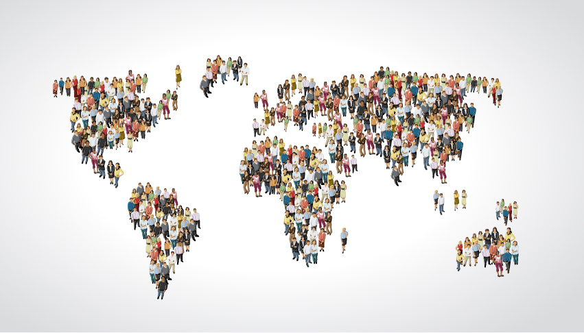
It’s estimated it took until the early 1800s for the world population to reach one billion – then in just another 200 years or so, it grew sevenfold. Today, it’s increasing by approximately 74 million people per year. And it is expected to keep growing. Estimates have put the total population at 11.2 billion by 2100.
With population growth, comes urbanization. Growing numbers of people are shifting from rural to urban centers with more than 50 per cent living in cities. This puts pressure on urban infrastructure, creating a need for efficient construction to keep pace, and drives environmental concerns. These factors contribute significantly to demand for more accurate, real-time geospatial data. The traditional 2D view of the world through maps is not enough anymore as our need for answers and insights has expanded in both time and space.
We’re seeing more and more organizations using 3D models of the real world for visualization and analysis to manage the built and natural environment, including uses in; property tax assessment, transportation and land use planning, water & air quality management, solar energy potentials, and emergency response.
New technologies such as mixed or augmented reality (AR) and building information modelling (BIM) combined with mapping techniques like LiDAR can help cities, industries and business overcome the challenges they face building denser cities while protecting nature. The adoption of the new technologies by public mapping agencies has often been limited. But many mapping agencies and private firms are innovating with new solutions.
Revealing the real world
I strongly believe that the democratization of proven, innovative technologies transforms not only the way organizations work but also how industries operate. The use of 3D geospatial content is the driving force behind progress and transformation in construction, infrastructure management, urban planning, and green initiatives.
Having the potential to disrupt traditional business practices, hybrid sensor solutions (RGB and XYZ) such as Leica Citymapper, the Pegasus Backpack and the Leica BLK3D provide access to 3D data that leads to better decisions, policy-making, and improves operational efficiencies.
The growing use of 3D geospatial content is driven by:
● Increases in the resolution, quality, and frequency, while costs are decreasing
● Emerging 3D web standards to simply and increase the development of applications
● Reduction in cost for cloud hosting of large 3D datasets
● Increases in compute platforms using 3D, including mobile and headset hardware.
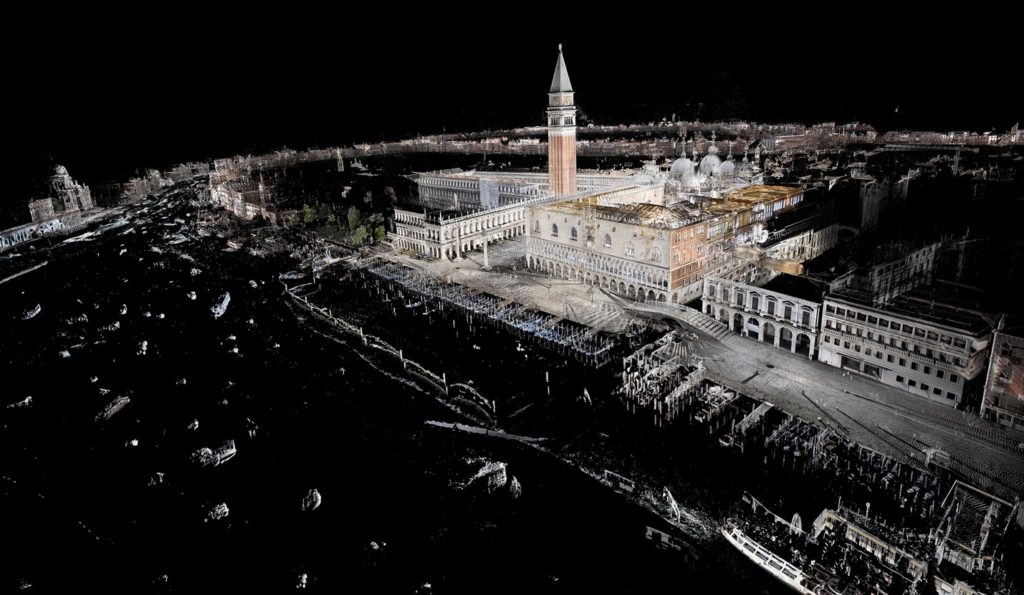
3D geospatial technologies reshape how cities are created, managed, experienced. For example, the HxGN Content Program provides valuable geospatial content and delivers professional-grade airborne images ready for machine learning exploitation via Amazon’s AWS cloud platform. The aerial imagery content is refreshed on a regular schedule of no more than two years, and data capture of entire states is done within one flying season. Current coverage includes the entire continental U.S., Puerto Rico, and areas of Canada and Western Europe.
Hexagon Geosystems is making significant investment in research and development to create new technologies, hardware and software that can capture, visualise and analyse geospatial data to reveal the world as it actually is.
This technology is not only changing the way we live or work but also changes the way we understand the world. The advent of new technology has the potential to transform utilities, transportation, public safety and to support environmental protection. As the world’s population becomes increasingly urban and the natural world feels our pressure, the need to map and measure change is key to maintaining our civilization. Human settlement mapping is now possible on a global scale with the results shared for all to see.
From preserving forests by collecting up-to-date information of what is happening on the ground to better natural hazard predictions for insurance to smart city planning, 3D geospatial technologies and data improve our decision making and make the world a better place to live and work. Proven by continued investment, the market tells us it is worth the cost.