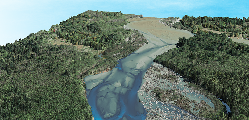
The HxGN Content Program is proud to have a network of partners to support our data acquisition, processing and selling, as well as provide expertise inside the geospatial industry. Each partner brings a unique set of value-added solutions to the market to help customers optimize their data use. The Partner Spotlight Series showcases the great work of our partners!

NV5 Geospatial, powered by Quantum Spatial, is North America’s largest geospatial services firm, providing insights to organizations that need geospatial intelligence to mitigate risk, plan for growth, better manage resources and advance scientific understanding. Not only does the HxGN Content Program highly complement NV5 Geospatial’s existing data acquisition capabilities, but we also enable NV5 Geospatial to develop a suite of solutions for numerous clients and derivative products.
NV5 Geospatial’s Profile
HQ: St. Petersburg, Florida, US
Year Established: 1930
Areas of Expertise:
- Lidar
- Digital Orthoimagery
- HD Videography and Oblique Imagery
- Multispectral/Hyperspectral Imagery
- Thermal Infrared Imagery
- Topobathymetric Lidar
- Enterprise GIS
- Geospatial Analytics
Value-Added Products:
- Feature extraction
- Feature mensuration
- Planimetrics
- Change detection
- 3D modeling
- Land use/land cover analytics
Solutions Overview
NV5 Geospatial combines the widest array of advanced remote sensing technologies with proprietary processes, analytics tools, algorithms, and analysis. It goes beyond data acquisition and measurement, transforming high-quality, accurate data into usable information tailored to meet its clients’ needs. Major government agencies, the military, and corporate organizations of all sizes, including utilities, oil and gas producers, engineering and construction firms, depend on NV5 Geospatial to revolutionize the way they use and value geospatial data through end-to-end solutions that push the boundaries of data and analytics.
What makes NV5 Geospatial unique?
BEYOND PIXELS AND POINTS – In a world challenged by ever more sensors, NV5 Geospatial has the tools and expertise to convert massive amounts of geospatial data into the answers that matter. The resulting insights can help mitigate risk, plan for growth, better manage resources, or advance scientific understanding.
STANDARD SETTER – NV5 Geospatial pioneered the use of Lidar and are now leading the way with 4D visualization tools and scalable cloud solutions. It stays up-to-date on the latest technologies and constantly pushes the bounds of geospatial analytics.
PARTNERSHIPS, NOT PROJECTS – NV5 Geospatial starts by understanding its clients’ business objectives and doesn’t stop until it gets maximum value from their geospatial data. Its dedication to client satisfaction and successful history of on-time, on-budget delivery has resulted in enduring, decades-long relationships.
PROVEN PERFORMANCE – Its track record includes everything from highly complex, multi-phase engagements to quick-turn assignments that require immediate mobilization. The team has surveyed and mapped remote rugged terrain, dense urban areas, long winding corridors, and multi-state expanses—all with the same commitment to superior outcomes.
ANALYTICAL STRENGTH – NV5 Geospatial’s multidisciplinary team includes experts in a variety of technical and scientific disciplines, including geology, biology, hydrology, forestry, and civil engineering. This specialized knowledge extends the range of analyses it can do for its clients—and the value of its clients’ geospatial investment.
To learn more about NV5 Geospatial, powered by Quantum Spatial, please visit nv5.com/geospatial.


