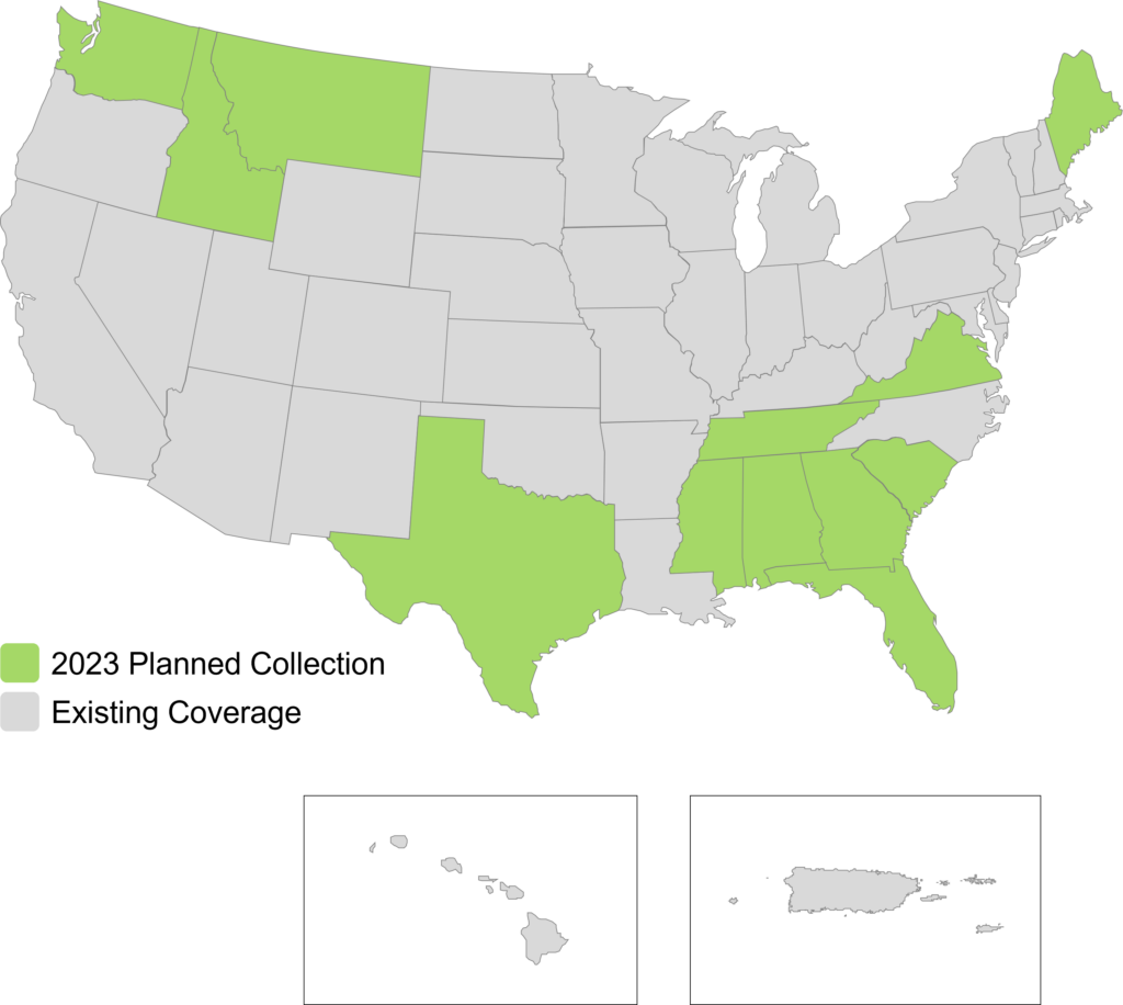
(Norcross, Georgia, U.S.A., 9 May 2023) Hexagon’s Geosystems division announced today that the HxGN Content Program will refresh aerial data of twelve U.S. states at 6-inch (15-centimetre) resolution for the 2023 collection season, namely Georgia, Mississippi, Alabama, Tennessee, Texas, Washington, Florida, South Carolina, Virginia, Maine, Montana, and Idaho.
Approximately 996,532 square miles (2,392,008 square kilometres) of updated high-resolution orthoimagery, stereo imagery and digital surface models will be added to the program. The four-band orthoimagery will be available through a streaming subscription using standard mapping APIs or via pixel download on the Hexagon Digital Reality (HxDR) Data Store, the new online store for purchasing aerial data from the HxGN Content Program.
“Reliable, high-quality geospatial data is the cornerstone of informed decision-making that leads to cost efficiencies and workflow optimisations,” says John Welter, President, Geospatial Content Solutions, at Hexagon. “Hexagon is proud to be refreshing high-resolution aerial data of 12 U.S. states, enabling actionable insights to support critical services and innovations.”
If you are interested in learning more about the refreshed aerial data in your state, please contact us at [email protected].