Exciting developments for licensed aerial imagery subscription models are motivating government organizations to take another look at their custom imagery acquisition programs. Traditionally, custom collects have offered control over the entire data acquisition and processing workflows to meet exact specifications. However, this often comes with higher acquisition costs, plus the costs associated with managing an RFP and maintaining the necessary IT infrastructure to store and share the data.
Conversely, licensed subscription models, while cost-effective, often come with restrictions on use, sharing and controls over precise specifications. This makes the lower-priced option impractical if the data doesn’t support the imagery program’s goals, leaving government organizations saddled with the burdens of a custom collect to get exactly what they need. Hexagon’s HxGN Content Program is looking to change all of that.
The HxGN Content Program’s Content+ offering is a unique licensing model built exclusively for state and local governments to access the best aerial data the market has to offer. Through the Content+ offering, states can realize significant cost savings for data access, guide acquisition specifications, and leverage flexible distribution and use terms. Further, it eliminates the complexities of collecting, storing and managing data. The offering allows states to quickly develop a comprehensive imagery program that supports analysis and planning by multiple agencies. The cost savings and freed IT resources can be reallocated to what matters most—directly servicing constituents, stakeholders and users.
Content+ offering drives aerial imagery data value
The HxGN Content Program’s baseline program provides direct and immediate streaming access to the most current state imagery. If new imagery is acquired over any part of the state within the subscription term, users also get access to that updated data set.
The Content+ initiative allows state and local governments to evolve beyond the baseline program by providing them with various options to tailor the data collection, such as leaf-off acquisitions, higher resolution refreshes of focus areas, and more frequent refresh cycles. The States of Texas and California have taken advantage of the flexible add-ons by purchasing their metropolitan areas at a higher resolution on the years between full statewide acquisitions. Areas of interest can be metropolitan areas, counties or even councils of government regions.

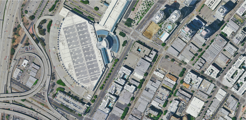
15-centimeter aerial imagery of downtown Los Angeles, California. Source: HxGN Content Program
The highest return on investment correlates directly with how widely the data is shared and used. Through the Content+ offering, government organizations within or directly affiliated with the state (even contractors performing work on their behalf) can access the imagery. Current subscribers find this a great way to ease the overall financial burden of the initial subscription or additional data buy-ups through the pooling of funds from all interested parties.
Furthermore, flexible payment options allow the cost to spread over the subscription term. While aerial imagery at native resolution cannot be shared publicly, a down-sampled version can be released for public domain access. Finally, licensing terms allow for use on public-facing websites and applications as long as the imagery cannot be downloaded. When considered together, these factors create a wide sharing ecosystem, enabling governments to get the full value of their data.
Texas Natural Resources Information System (TNRIS) joined the HxGN Content Program in 2020 after careful consideration of its options with the help of AppGeo, Hexagon’s resale partner. Hexagon’s license flexibility was a major selling point, even more than the significant cost savings. It was important to TNRIS to be able to provide input on collection areas and urban boundaries and match legacy data specifications. Permission to make 12-inch resolution aerial imagery available in the public domain while retaining the use of 6-inch imagery for the state sealed the deal.

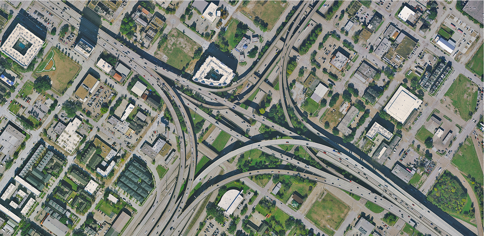
15-centimeter aerial imagery of a freeway junction in Houston, Texas. Source: HxGN Content Program
City insights from multiple data sets
The Content+ initiative now customers to add on the HxGN Content Program’s Metro HD city data, providing ultra-high-resolution 2D and 3D data sets of large metropolitan areas. With the Metro HD add-on, states determine their urban area of interest and select from 10 data sets, including aerial orthophotos, LiDAR point clouds, oblique imagery, 3D meshes and land cover maps. The subsequent data products are added to the HxGN Content Program for broader access and cost-sharing, making access more affordable.
Each city is captured using the Leica CityMapper-2, the world’s only true hybrid sensor that concurrently collects nadir and oblique imagery and LiDAR point clouds. Hybrid acquisition results in superior accuracy and temporal consistency across all dimensions by leveraging the strengths of passive and active imaging. These value-added data sets satisfy even the most demanding city modeling applications and support unique insights that enable smarter, data-driven decisions.
Get rid of the headaches
The Content+ offering is a game-changer for state and local governments that have struggled to develop an effective aerial imagery program while coping with budget, technology and personnel limitations. The licensed content model meets the needs of a variety of users with flexible use terms, pricing, delivery methods and product specifications. Temporality and consistency of the imagery are a priority for the HxGN Content Program, while valuable add-ons such as leaf-off imagery, higher refresh cycles and the Metro HD city data are available to support in-depth custom analysis. The opportunity to pool resources and share costs between multiple entities goes a long way toward making geospatial data available to everyone.
Download the brochure to learn how the Content+ initiative can work for your aerial imagery program, or sign up for a free 10-day trial to stream our aerial imagery through WMS/WMTS, SOAP and REST protocols.


