


The rise of machine learning in geographic information systems (GIS) has broadened the horizon of geospatial analysis with more efficient, precise techniques beyond human capabilities. By training algorithms to detect features and predict patterns using geospatial imagery, GIS users can gather actionable data and derive deeper insights for critical decision-making.
The process of converting geospatial imagery into feature maps is time-consuming and costly. First, a considerable amount of time is spent intaking large amounts of imagery data. From there, trained GIS professionals begin annotating the data, a manual task of marking data with metadata as groundwork for training machine learning algorithms.
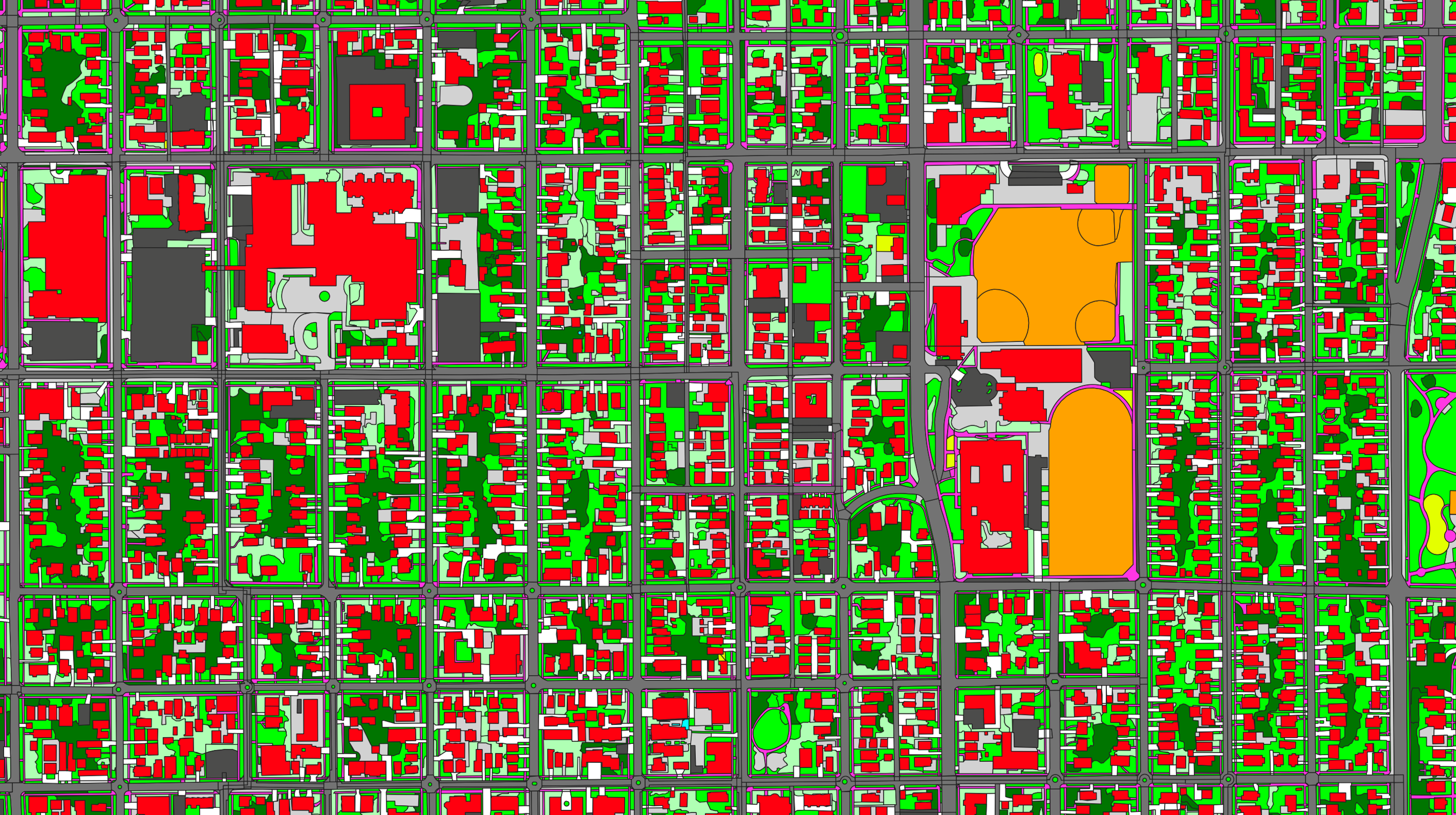
To simplify this process, Ecopia Tech, an AI company specializing in feature extraction, developed plug-and-play feature maps using high-quality aerial imagery from the HxGN Content Program, Hexagon’s aerial imagery program.
Creating 3D vector maps using aerial imagery
Ecopia has spent the last decade developing the next generation of automation with cost-effective feature maps nationwide. Over the next five years, Ecopia will address the increased demand for elevation data and 3D vector features with its first 3D vector map covering the continental US, Hawaii, and major Alaskan metros.
Utilizing coast-to-coast stereo imagery from the HxGN Content Program, Ecopia adds height attribution to its 2D vector features to create 3D content of the entire country. The solution will include 14 classes of extracted natural and man-made features in ready-to-use layers for statistical analysis and modelling.
Ecopia’s 3D feature maps are beneficial across several applications such as canopy coverage, sidewalk inventory for ADA compliance, 5G access point placement, and 3D models for smart cities. By partnering with the HxGN Content Program for its 3D initiative, Ecopia enables analysis capabilities that will help hundreds of companies and communities make smarter decisions.

More than meets the eye
Successful feature extraction starts with reliable imagery. Large, consistent, and accurate data sets ensure that machine learning algorithms are set up for success. Hexagon upholds consistency at every stage, from superior capture technology and careful acquisition planning to meticulous data processing techniques. The HxGN Content Program emphasizes data quality to safeguard consistent data inputs for fuelling AI engines.
Additionally, the HxGN Content Program offers wall-to-wall coverage of the United States. Its breadth of high-resolution data enables Ecopia to scale its feature extraction technology and 3D vector maps nationally.
“The exceptional data consistency over large areas makes the HxGN Content Program an ideal data set for machine learning algorithms,” says Bill Singleton, Vice President of Sales at Ecopia. Through its partnership with Hexagon, Ecopia makes the daily lives of GIS professionals much easier by eliminating the costly, laborious task of transporting and annotating data.
Watch the virtual presentation to learn about how Ecopia Tech is leveraging Hexagon’s high-quality aerial imagery to advance large-scale geospatial data feature maps and analytics, or visit Ecopia’s website for more information.