


Spatial resolution plays a critical role in establishing the level of detail visible within an image. Knowing which resolution is required at the front end of your project will impact how small and sharp objects are represented throughout the data.
The appropriate imagery resolution for your project is driven by the smallest item to be identified on the ground. In functional terms, spatial resolution acts as the maximum allowable zoom level to positively identify, isolate and extract features. If the spatial resolution meets this requirement, it is also theoretically possible to distinguish all features larger than the imagery resolution.
In this article, we will explain why spatial resolution matters and why not all resolutions are created equal through examples of use cases for both high- and low-resolution imagery.
How do I know which aerial imagery resolution to choose?
When discussing the spatial resolution of geospatial imagery, it commonly refers to ground sample distance (GSD), meaning the length and width that one pixel occupies when projected from an imaging sensor to the ground. Thus, GSD defines the smallest spatial unit on the ground that the sensor can distinguish from its surroundings.
The smaller the area of ground represented by one pixel, the higher the resolution and the finer the observed details. For example, a 15-centimetre resolution image can show details of objects on the ground equal to or greater than 15 x 15 cm. Smaller objects would blend into their background. Today’s common image resolutions are 120 cm, 60 cm, 30 cm, 15 cm, 5 cm and 2 cm, where everything below 30 cm native resolution is exclusive to aerial imagery collected with an aircraft. Higher resolution images are predominantly collected in densely populated areas where every detail matters.
The case for high spatial resolution
- Scenarios involving relatively small features: Lower resolution would result in coarse object representations or blurry feature boundaries, which are key to successful identification and extraction.
- Detailed change detection studies: Higher spatial resolution facilitates smaller, incremental changes to be detected, classified and monitored.
- Artificial intelligence (AI) and machine learning (ML) algorithms: As resolution increases, so does the richness of features available for analysis and the ability to identify and extract confidently.
The case for low spatial resolution
- No need to identify small features: Lower resolution imagery is suitable when there is no need to identify small, individual items on the ground.
- Scenarios where cost is a driving factor: Lower resolutions are typically a more cost-effective option than higher resolutions.
- Analysis of wide areas: Studies that are more regional in nature or macro analysis of large areas such as remote monitoring for environmental analysis, forest health studies, agricultural land management or entire neighbourhoods to analyse urban sprawl.
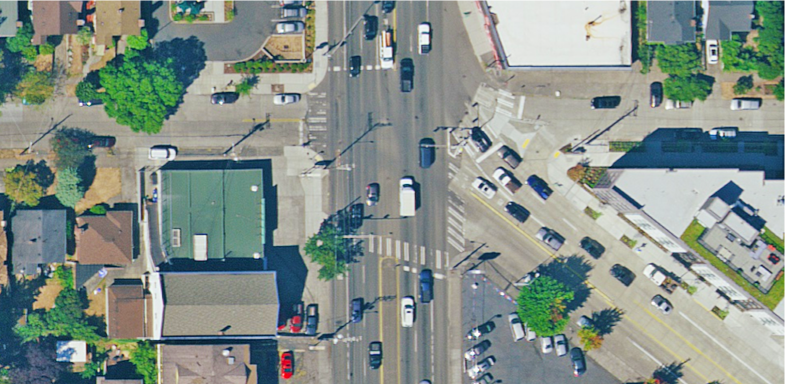
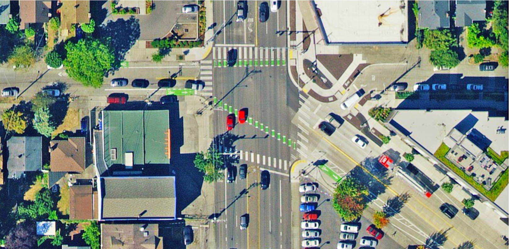
Aerial image of changes to an intersection, including pedestrian crossings. Source: HxGN Content Program
Applications for high- and low-resolution aerial imagery
To illustrate the resolution selection process, let us look at different use cases for high- and low-resolution imagery.
In precision agriculture, when individual crops are small and in close proximity to each other, extracting trends in plant health would require high-resolution aerial imagery. However, for monitoring large land cover changes, such as loss of agricultural areas to urban or exurban development, low-resolution imagery may be a better fit since changes are monitored at the city block level or larger. There is less need for precise monitoring of small, individual ground objects in the second scenario.
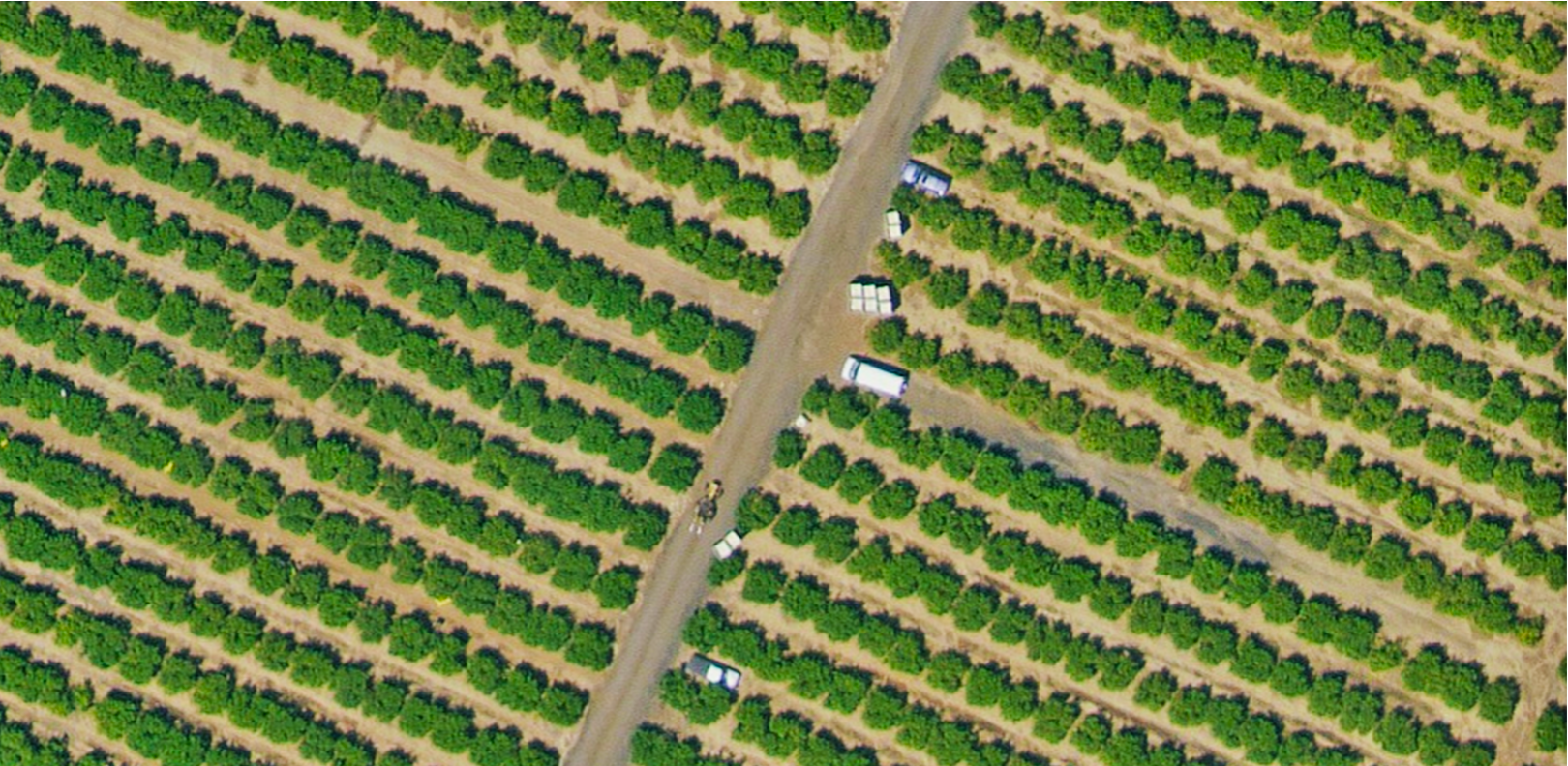
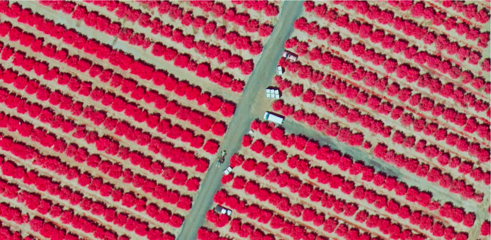
15-centimetre resolution aerial imagery of vegetation shown in true colour (left) and colour-infrared (right). Source: HxGN Content Program
Applications in the construction industry can also use various spatial resolution levels. Lower resolution data can provide adequate information on landform modelling and proximity analysis for projects involving site selection, mobilisation and pre-phase planning. When construction is underway, higher spatial resolution data is needed to effectively monitor progress, change or conduct quantitative analyses to project specifications.
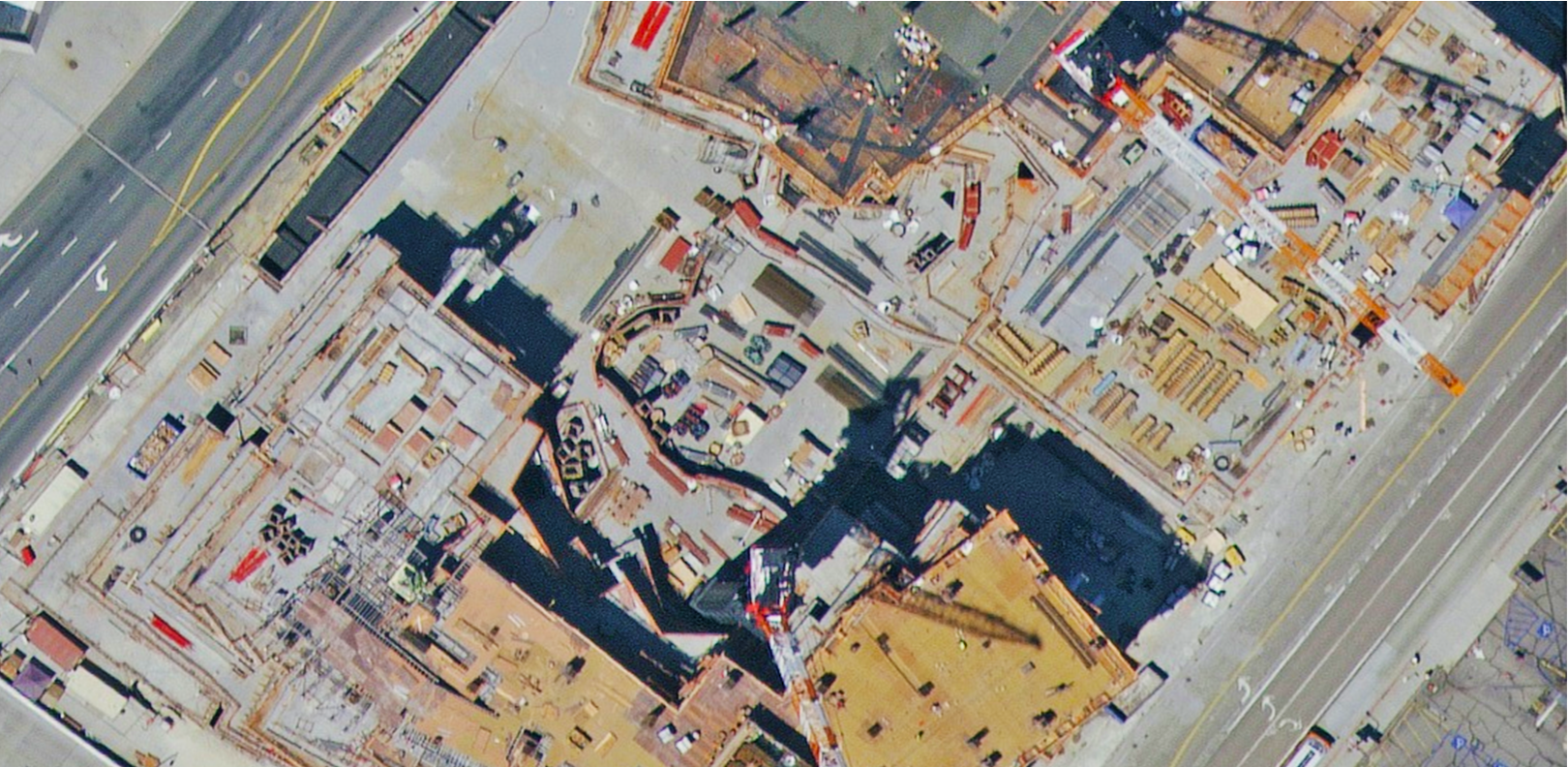
15-centimetre resolution aerial imagery of a construction site. Source: HxGN Content Program
Both high-resolution and low-resolution imagery can be used when training AI and ML algorithms capable of automated feature extraction. For planning and deploying 5G infrastructure, networks of small cells located within line of sight are required to ensure maximum coverage and capacity. Finding ideal locations for small antenna systems require high spatial resolution and high-quality aerial imagery plus digital surface models to produce accurate 3D building footprints, tree locations, canopy models and land cover maps that meet the stringent requirements for 5G wireless network development.
When it comes to extracting large features such as building footprints for 5G design or swimming pools for insurance underwriting, lower resolutions will suffice as the individual units on the ground are significantly bigger.
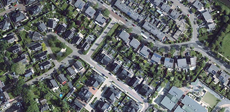
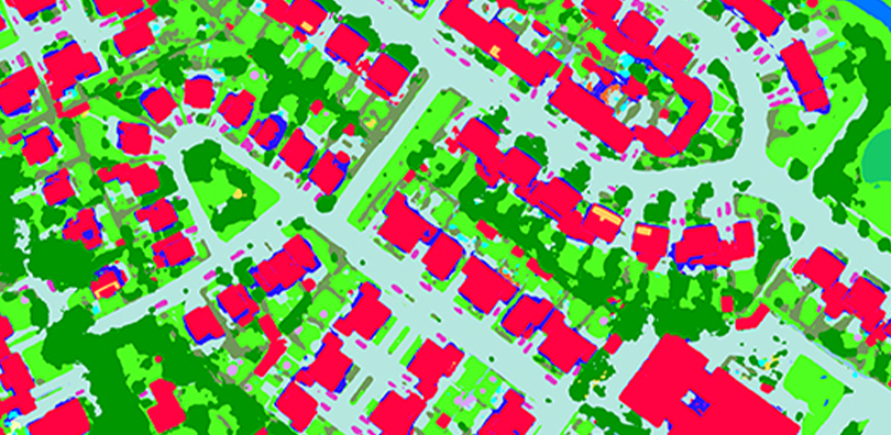
High-resolution aerial imagery (left) derives highly accurate land cover maps (right). Source: HxGN Content Program
Hexagon’s approach to high-resolution aerial imagery
The HxGN Content Program, Hexagon’s aerial data program, offers the world’s largest library of aerial imagery, elevation data, 3D models and analytics. High-resolution countrywide aerial imagery is available for the contiguous United States and Western European countries. In major cities, the HxGN Content Program’s Metro HD city program offers ultra-high-resolution 2D and 3D data sets derived from simultaneously captured aerial imagery and LiDAR data, enabling superior accuracy and temporal consistency.
Hexagon’s aerial data is captured on a pre-planned refresh schedule using Leica Geosystems’ high-performance airborne sensors equipped with mechanical forward-motion-compensation (FMC). This technology, unique to Leica Geosystems imaging sensors, enables to capture very sharp imagery even in challenging lighting conditions such as shadow areas and urban canyons. The FMC enables longer exposure times and optimised camera settings that decrease image blur and therefore provide superior image quality.
Further, our rigorous QA/QC methodology guarantees high quality as all data is processed using ground control to correct seam lines, colour and any negative effects. Orthorectification removes scale inconsistencies to ensure high positional accuracy of the data, while colour balancing during the mosaic process creates a pleasing visual representation of the scene.
Key takeaways for selecting the right resolution
Imagery resolution controls the visible details captured in an image – a crucial factor when selecting the right data set for your project. In general, higher resolutions provide greater detail of small features on the ground, while lower resolutions are more cost-effective for monitoring large areas at scale. Selecting the optimal data set can save time and money during the lifecycle of a project as the data is fit for purpose and thus more efficiently processed, stored and accessed.
To learn more about Hexagon’s HxGN Content Program, please visit hxgncontent.com.