


When Pitkin County Geospatial Technical Lead Mary Lackner put out a Request for Proposal (RFP) for aerial imagery of the entire county, she got more than she bargained for – about 1,000 square miles (approximately 2,690 square kilometres) coverage and a confirmed accuracy report that easily exceeded the advertised specifications.
CompassData Vice-President Hayden Howard wasn’t surprised, though. With a cost-effective method to provide the imagery, the firm used the HxGN Content Program not only to meet the needs of the county but also to surpass the RFP’s requirements.
Mapping in the mountains
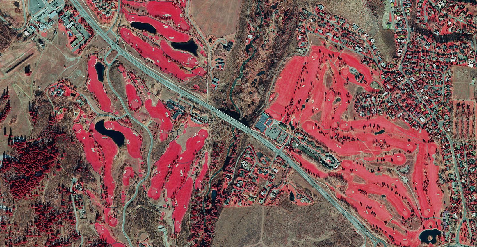
Pitkin County, located in Colorado, USA, is known for its skiing resorts being the home of Aspen. Covering 980 m2 (2,538 km2), the county is in the heart of the White River National Forest, surrounded by the central Rocky Mountains.
With the changing nature of the landscape, Pitkin County aims to update its aerial imagery reserves every four years. The data is then used across county management for various purposes, such as:
- Geographic Information Systems (GIS) base maps
- Public safety dispatch routes
- Property assessments
- Insurance inspections
- Irrigational land development
With approximately 85 per cent of the county used for public purposes and the other 15 per cent privately owned, flying the entire county was cost prohibitive. The RFP encouraged creative suggestions to overcome this challenge.
Getting more for less
 In his proposal response, that’s exactly what Howard and CompassData offered. Introducing Lackner and the county to the HxGN Content Program, the two organisations teamed to provide a means for a more affordable data set at a cost savings of approximately $64,000 USD. Collected in the fall, the HxGN Content Program had complete coverage of Pitkin County at the required 1-foot (30-centimetre) resolution and provided 4-band above the requested 3-band imagery.
“Due to the HxGN Content Program’s affordability, we were able to receive more coverage than we were expecting and save money on the project,” said Lackner. “CompassData offered some unique methods, and especially since this is our first time working with the firm for imagery, we are really pleased with the results.”
CompassData is an expert supplier of geospatial products and services specialising in high precision and accurate GNSS-based data collection, ground control surveys, mobile mapping, aerial photography, processing and verification, drone technologies, and GIS integration. Also located in Colorado, the firm is quite familiar with Pitkin County, and as an imagery reseller and the ground control point provider for the HxGN Content Program in the United States and Europe, CompassData is well versed in the possible applications of the imagery collected with Leica Geosystems airborne sensors.
“Over the years many wide area imagery programs have come and gone, but Hexagon has stated what it will do, what it will provide, and it’s stuck to it,” said Howard. “When we see the right opportunity, we encourage our clients to use the HxGN Content Program, especially for the accuracy of the imagery.”
Surpassing the standard
 The American Society for Photogrammetry and Remote Sensing (ASPRS) Class 1 accuracy standard calls for 1-ft (30 cm) resolution data to have a root mean square error (RMSE) of 60 cm (2 pixels). The RFP required Class 1 accuracy standards and no less.
The HxGN Content Program imagery of Pitkin County surpassed the Class 1 standard at 1.36 pixels RMSE, well under the 2 pixel accuracy requirement. CompassData performed its own quality assurance on the data. Surveying 50 new ground control points to ensure the accuracy, the firm verified the accuracy surpassing the ASPRS standard.
“Using 5 cm, or better, accurate grounds control points, we were able to verify the higher accuracy of the HxGN Content Program imagery we provided to Pitkin County,” said Howard. “With the higher accuracy in the imagery, base maps, inspections and all applications the imagery will be able to give our clients a better understanding of what they actually have.”
Getting more than you bargain for usually doesn’t end positively. In this case, though, not only was it a good experience, but it also opened other possibilities for airborne imagery. According to Howard, without the RFP’s open concept, this different way of operating wouldn’t have been possible.
“For CompassData to come forward with such a solution to save this much, with this level of accuracy, and being current data, this has been eye-opening,” said Lackner “The HxGN Content Program is really a new way to conduct business.”
Download this case study.