The HxGN Content Program is proud to have a network of partners to support our data acquisition, processing and selling as well as provide expertise inside the geospatial industry. Each partner brings a unique set of value-added solutions to the market to help customers optimise their data use. The Partner Spotlight Series showcases the great work of our partners.

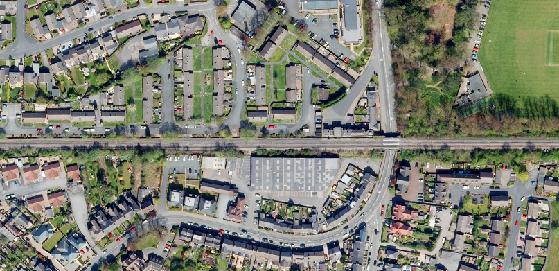
Bluesky has developed a strong, collaborative relationship with Hexagon over several years, therefore joining the HxGN Content Program was a natural extension of the existing relationship between the two companies. With the recent initiative to license Bluesky aerial imagery of Great Britain, customers beyond the United Kingdom and Ireland will have easy access to Bluesky data through the HxGN Content Program. Bluesky and Hexagon’s mutual drive to enable its customer’s success embraces the true meaning of working in partnership.
Bluesky’s Profile
HQ: Ashby–de–la–Zouch, Leicestershire, United Kingdom, with offices throughout the UK, US, Republic of Ireland as well as a dedicated production centre in India
Year Established: 2003
Area of Expertise: Bluesky maintains seamless aerial photography, height data, and tree mapping on a national scale in both Great Britain and the Republic of Ireland and also undertakes bespoke surveys, including LiDAR, for a range of public and private sector clients on both sides of the Atlantic.
Service Overview
As an established and respected aerial survey company, Bluesky is highly innovative and continually strives to tackle and solve industry problems by embracing new technology and methods, including machine learning and artificial intelligence. This has resulted in the development of some groundbreaking products such as the National Tree Map, which details the location and attributes of trees across Great Britain and imminently will also cover the Republic of Ireland, and the MetroVista™ product range which includes vertical, oblique, LiDAR and Mesh Model data.
These datasets underpin long-term contracts with local and central governments and many major blue-chip companies from a range of market sectors, including financial services, utilities, telecoms, geospatial web portals, construction, and environment.
In addition to its published data capture programme and bespoke survey services, Bluesky utilises its extensive expertise to produce a diverse range of derived and complementary data solutions. These include precision height data (DTM/DSM), 3D Building Models and Mesh Models, Topographic Mapping, Tree Mapping, NDVI (Normalised Difference Vegetation Index) and thermal mapping. Bluesky is a Licenced Partner of Ordnance Survey (OS), the national mapping agency for Great Britain, and is able to supply a range of OS mapping products.
Bluesky operates six aircraft and aerial survey cameras and sensors, including two Leica CityMappers, which allows the simultaneous collection of vertical and oblique imagery and LiDAR data. These systems position Bluesky at the cutting edge of aerial survey capability enabling the collection of unique and cost-effective geospatial solutions for both bespoke projects and “off the shelf” data.
Hexagon & Bluesky’s Partnership
Bluesky has been working with Hexagon for several years, both in the United Kingdom and the United States. Bluesky undertakes flying acquisition work for the HxGN Content Program in the U.S., capturing 15 cm and 30 cm resolution imagery using the Leica Geosystems ADS100 digital sensor. In the U.K., Bluesky now licences its national datasets through the HxGN Content Program to Hexagon’s global customers under flexible licensing terms. Bluesky’s partnership with the HxGN Content Program has contributed to the successful expansion of its flying resources in the U.S. and has also meant that Bluesky’s aerial imagery of Great Britain has been licensed to customers that Bluesky would not otherwise have been able to access easily.
To learn more about Bluesky, please visit bluesky-world.com.


