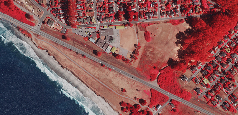
For many applications, particularly those involving vegetation and wetlands, the fourth band in an aerial imagery product provides a wealth of information. The fourth band refers to the near-infrared (NIR) wavelength in the electromagnetic spectrum, invisible to the human eye but a valuable tool for image analysis and change detection. A colour-infrared (CIR), or false colour image, is composed of NIR, red and green bands, while a true colour image displays the visible red, green and blue bands. By displaying the invisible NIR band as a visible band, the NIR reflectance values can be “seen” and analysed.
Colour-infrared valuable for vegetation analysis
In a CIR image, the internal cell structure of vegetation strongly reflects the NIR wavelength, providing a more robust indicator of plant health than the visible green wavelength reflection of chlorophyll in the leaves. On your computer, the NIR band is typically displayed as red for easy identification, and different shades of red colour show varying levels of plant health and vigour. A healthy plant is bright red, while dead, dormant or unhealthy plants are lighter shades of red or blue-green.
At the same time, water absorbs the NIR wavelength so it appears black in a CIR image. Therefore, CIR images are used to assess the turbidity, or quality, of water. Sediment and suspended particles in water are detected by the NIR wavelength and are seen as shades of blue instead of black.
What to look for in colour-infrared photographs
Keeping in mind that vegetation absorbs the red and NIR wavelengths at a higher percentage than blue and green wavelengths, the human eye and computer recognition technology can distinguish variations in vegetation more easily in a CIR image, which makes them ideal for analysis.
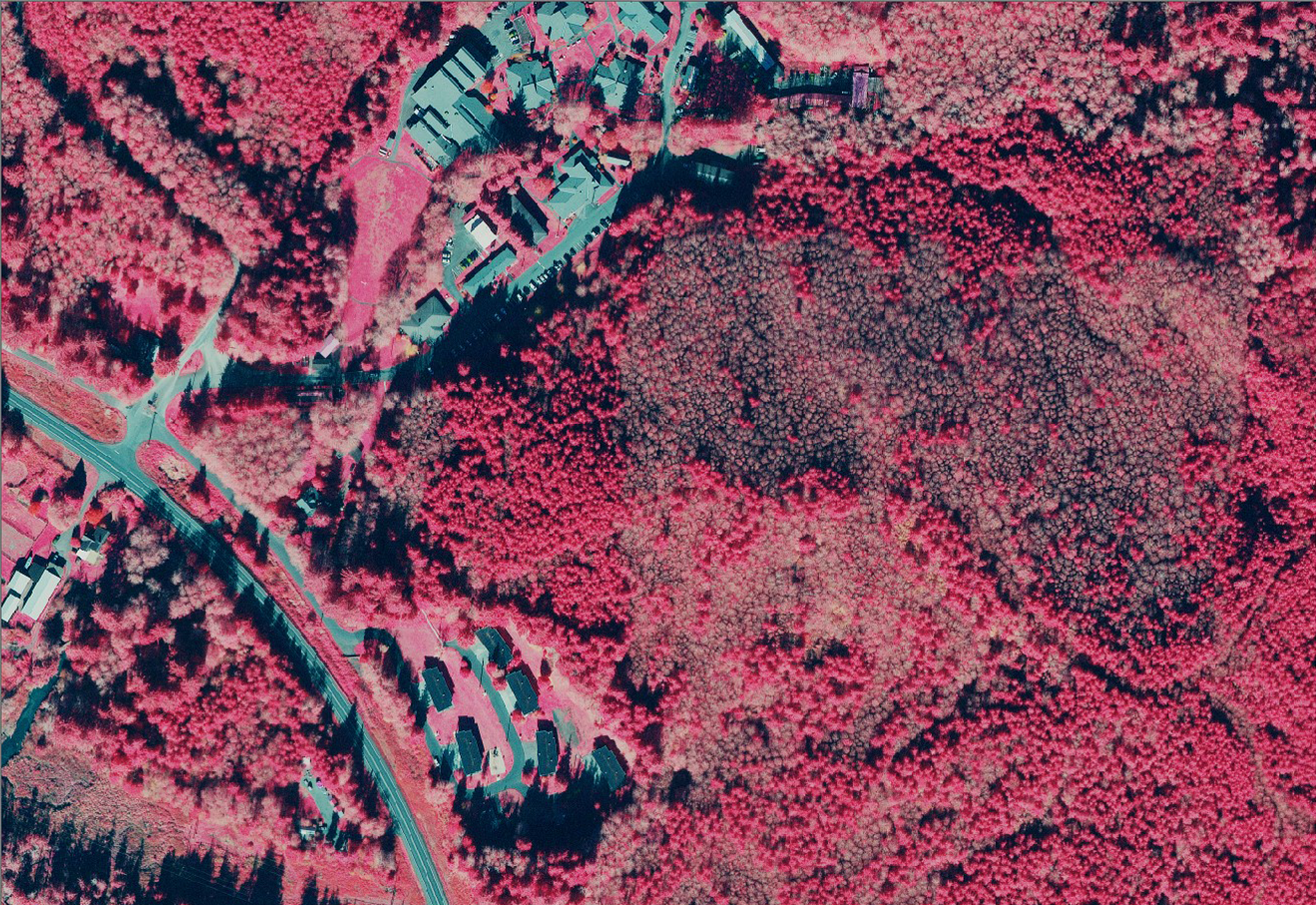
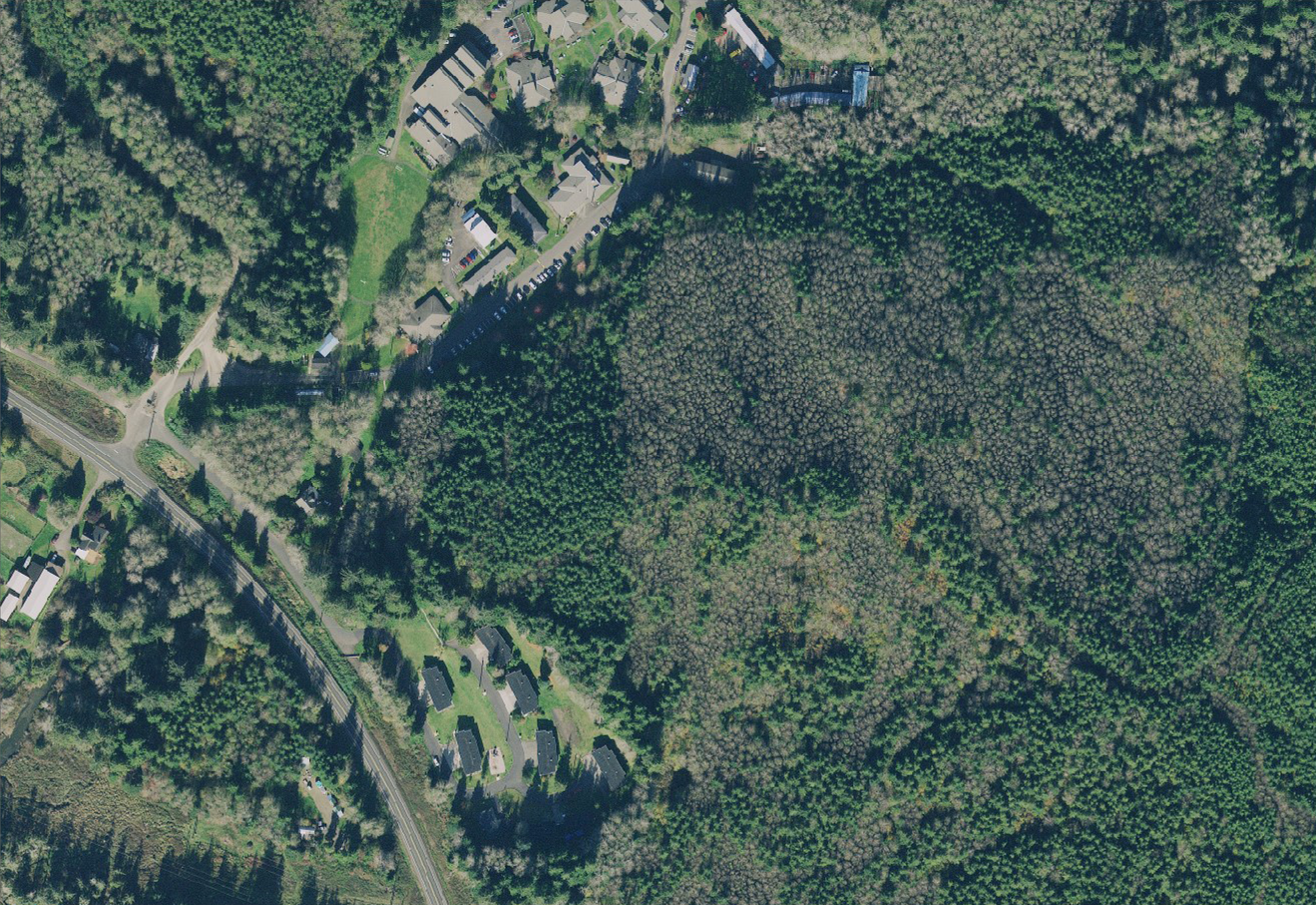
In the following example, the CIR image on the left clearly shows different shades of red for dense canopy and other vegetation species, while structures and roads appear blue-green. The RBG image on the right shows shades of green that are more subtle and the structures are less distinct.
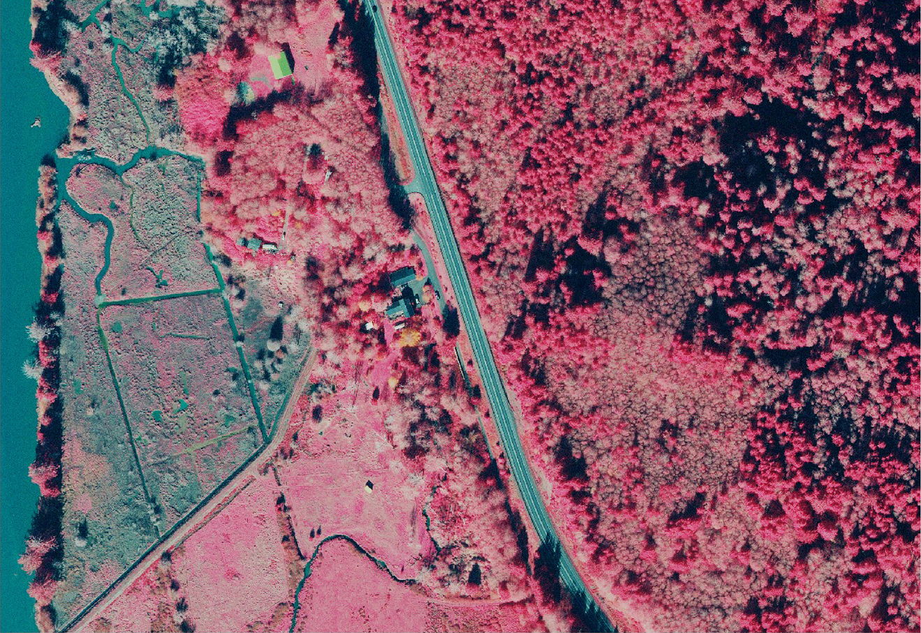
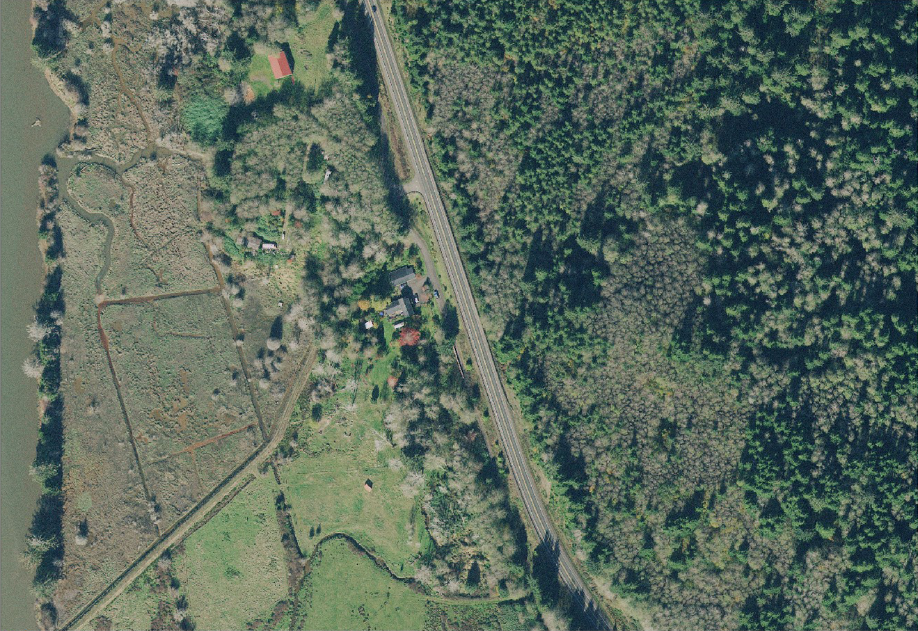
The next example shows a contrast in vegetation health, as well as diverse plant species. In the CIR image on the left, the vegetation along the shoreline is blue, which means it is unhealthy or dead, but you can see there are patches which are still pink and somewhat healthy. This distinction is not apparent in the RGB image on the right due to the lack of contrast. Also, in the CIR image you can detect different species of trees near the house in the upper left corner, as they have a different yellowish colour not seen elsewhere in the area.
Aerial colour-infrared photography serves broad range of applications
CIR film has been around since World War II when it was used to identify camouflaged military vehicles. In CIR images, green vegetation would appear red, while equipment painted green or covered with cut vegetation would appear blue-green. Since then, CIR has proven to be a valuable tool in other industries. For any application that involves quantifying vegetation, assessing vegetation health, identifying individual species of vegetation, and estimating water turbidity and soil moisture, CIR images provide invaluable insights.
- Forestry: The forestry industry benefits from aerial mapping as an efficient and cost-effective method of collecting data over large, hard-to-reach areas. Analysing CIR images of forests is more accurate than acquiring samples on the ground for forest management/mapping, forest/tree health, tree classification, forest fire re-growth monitoring, and deforestation monitoring.
- Agriculture: Some sectors of the agriculture industry use CIR aerial imagery on a global scale to estimate the amount of land planted to specific crops and predict food availability, while individual farmers use the technology at the field level to assess vegetation health, address issues and increase yields.
- City Management: High-resolution CIR aerial imagery is used for many urban applications. It provides valuable insights for vegetation management, urban forest analysis, land use studies, parks and recreation management, and analysis of pervious versus impervious surfaces.
- Utilities: Utilities use CIR imagery to monitor and manage vegetation encroachment along powerlines and pipelines. Early detection of unhealthy trees can avoid outages and damage to crucial infrastructure.
- Environmental Science: Environmental studies rely on CIR imagery for wetland delineation, stream and river erosion delineation, invasive species monitoring, vegetation classification, and land use/land cover mapping.
Hexagon provides colour-infrared photographs with every order
The HxGN Content Program is the world’s largest library of aerial orthophotos, digital surface models (DSMs), and stereo images across the United States and Europe. As the premier data provider to a diverse range of global customers, we recognize the unique value of CIR imagery data ─ which is why we include it with every orthophoto purchased.
Under the HxGN Content Program, whether you stream or download pixels, your imagery data includes access to two 3-band layers (RGB and CIR). With our CIR-focused customers in mind, we also offer a custom 4-band pixel download option to help reduce data volume and improve usability for CIR-specific activities.
CIR imagery opens up new opportunities for analysis in forestry, agriculture, environmental science and more. Check out the Coverage Map to see the latest 15-cm and 30-cm resolution aerial data for your CIR applications.


