






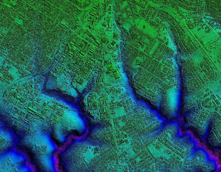
In 2022, a leading South African geospatial services firm identified a growing need for higher-resolution elevation data to satisfy applications in multiple sectors across the nation. A 25-meter digital elevation model (DEM) had been developed years before, but the mapping community in South Africa required 1- and 2-meter resolution elevation data for modern applications.
The geospatial firm – GeoSpace International – had been awarded numerous surveying and mapping projects by the country’s national mapping agency, the Chief Directorate: National Geo-Spatial Information (CD:NGI). GeoSpace saw a unique opportunity to drive a major new DEM project that would benefit end users throughout South Africa.
Fortunately, much of the high-quality aerial imagery that could serve as the basemap for the project was already collected. Annually, CD:NGI tenders the capture of aerial imagery and orthophotos, covering several quarter-degree blocks. Since 2017, GeoSpace has been capturing imagery for CD:NGI using the Leica DMC III airborne mapping sensor. Six years later, GeoSpace had flown nearly 100% of the 1.2 million square kilometre land area at 25-centimetre resolution.
GeoSpace saw this imagery data as the foundation for the higher-resolution DEM datasets and sought partners to make the nationwide project a reality.
Building a solutions partnership
The existing 25 cm aerial imagery was an ideal start to the elevation project because of the DMC III’s large-format digital camera design. Made for photogrammetric mapping, it captures aerial data with high accuracy both horizontally and vertically, and it achieves 25 cm GSD from an altitude of 20,000 feet AGL with 60/25 percent overlap. It is a faster and more cost-effective means of mapping elevation over large areas than airborne LiDAR techniques, which are designed for smaller projects.
The desired 3D elevation data could be extracted from the 25 cm imagery that had already been, or was in the process of, being captured. The challenge, however, was processing the massive volume of raw imagery data to derive the elevation products. The computer power and processing capabilities required for the project and its short timeline of two years would be enormous and did not exist in South Africa.
“We are an aerial mapping company and did not have the resources to handle an elevation data processing project of this scope,” said Bernard Jacobs, Director of GeoSpace. “The Hexagon Content Program, on the other hand, already had the resources in place to do it.”
The Hexagon Content Program was already completing projects at this scale in North America and Europe. Hexagon had the processing software, computer infrastructure, and knowledge to generate the elevation models from the 25 cm aerial imagery for all of South Africa. The Leica HxMap post-processing workflow is a key component of these processing capabilities.
As Hexagon’s reseller in Africa, GeoSpace conferred with Hexagon to collaborate on the elevation project. The structure for the partnership already existed in the Content Program, which engages acquisition partners to collect aerial data. Meanwhile, Hexagon conducts the data processing using standardised cloud-based workflows to deliver consistently high-quality products regardless of geographic location.
“Hexagon had the processing capacity available in the cloud to partner with GeoSpace on the project,” said Stephen Minnaar, MEA Sales Manager at Hexagon. “We essentially used the same standards, workflows and procedures developed for the Content Program and applied them to the South Africa DEM project.”
To assist with the extraction of vegetation layers and building footprints in the project, GeoSpace partnered with RiskScape, a South African geospatial and actuarial company. RiskScape specialises in the application of machine learning algorithms for determining risks related to disasters, climate change, and other phenomena.
Deriving elevation from aerial imagery
As GeoSpace continued collecting aerial data with the DMC III, Hexagon began processing the raw four-band imagery to initiate the photogrammetric extraction of elevation points. Working with the HxMap software, Hexagon’s photogrammetrists generated a point cloud and an initial digital surface model (DSM) using the semi-global matching process.
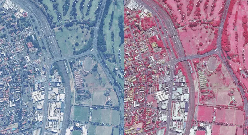
Figure 1. RGB (left) and NIR (right) point cloud data sets were generated using the HxMap software (Source: Hexagon)
The point cloud contained surface elevation values on a 25 cm spacing on the same grid system that divided the nation into 439 quarter-degree square blocks of about 2,800 square kilometres each. Because the points were determined photogrammetrically, they represented elevations of surface features, including trees, building structures and other objects on the ground, but the files also contained the spectral data (red, green, blue, NIR) from the raw DMC III imagery that would assist in mapping actual terrain.
Hexagon delivered the DSM and point cloud to RiskScape for additional processing. The firm applied filtering and automated classification techniques to the point cloud to differentiate non-ground from ground features – a key aspect of generating bare earth or digital terrain models (DTM).
RiskScape’s technicians applied automated feature classification algorithms to the point cloud to initially separate out water, vegetation, and building features. A normalised difference vegetation index (NDVI) was then used to distinguish vegetation by type and also differentiate non-vegetation ground surfaces.

Figure 2. The orthoimagery (left) is overlaid with an NDVI (right) to indicate vegetation. (Source: RiskScape)
“Being able to extract that vegetation information from the point cloud was quite critical in getting rid of the non-ground vegetation information,” said Thorgny Fjastad, GIS Specialist at RiskScape, adding that this process did not create a final DTM because not all vegetation is above ground level.
Grass, for instance, essentially represents the ground, or terrain elevation because it is short. RiskScape used a surface roughness filter, derived from the initial DSM, to further distinguish grass at ground level from bushes and trees above the ground. Grass typically has a smooth texture compared to other vegetation. This prevented short vegetation from being unnecessarily filtered from the DTM generation process.
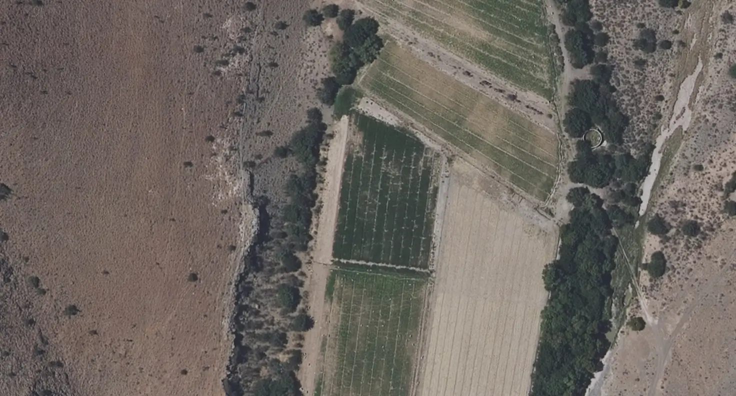
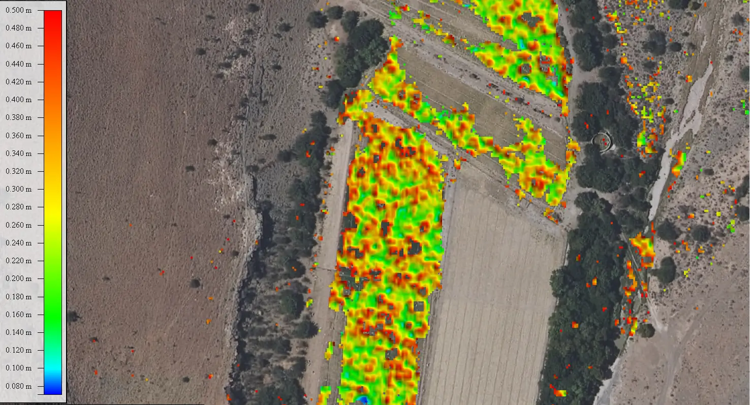

Figure 3. The vegetation roughness variation is shown over grass or ground-based vegetation and trees/bushes or non-ground vegetation. The orthoimagery (left) is overlaid with the smoother ground-based vegetation (center) and rougher non-ground vegetation (right). (Source: RiskScape)
In the final phases of generating the DTM and supporting data sets, RiskScape applied machine learning algorithms to extract building footprints. The firm also extracted water bodies and gradients from the point cloud and then delivered the DTMs back to Hexagon along with data layers containing the surface roughness categories, building footprints, and vegetation classes for the generation of product deliverables.

Figure 4. The building footprints are extracted and created by the machine learning model. (Source: RiskScape)
Hexagon merged all these feature layers with the point cloud data into a “pseudo-image,” or raw DSM, colourised with the orthoimagery’s spectral data. Hexagon’s photogrammetrists performed additional classification of the ground and non-ground points to generate the final DTMs, with 95% of all features above 1.5 meters in height removed.

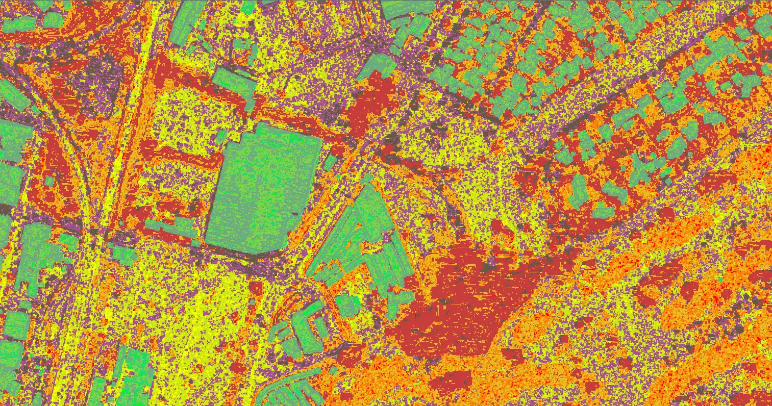
Figure 5. The RGB orthoimagery (left) compared with the final “pseudo-image” (right) where each colour represents a different classification. (Source: RiskScape)
“The team ultimately produced a 1-meter DSM as well as 2- and 5-meter DTMs nationwide,” said Minnaar. “The resulting products constitute the first homogeneous, countrywide and current commercial elevation dataset available for South Africa.”
The DSM and DTM datasets provide the accuracy and detail required for projects related to 5G telecommunications, defence and intelligence, hydrologic analysis, digital construction and planning, and more. Explore the datasets on the Hexagon Digital Reality (HxDR) platform, where you can connect to the GeoSpace and RiskScape teams to place an order.
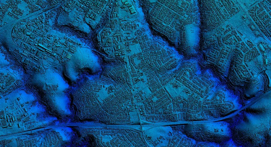
Figure 6. Final 1-meter DSM product (Source: Hexagon)
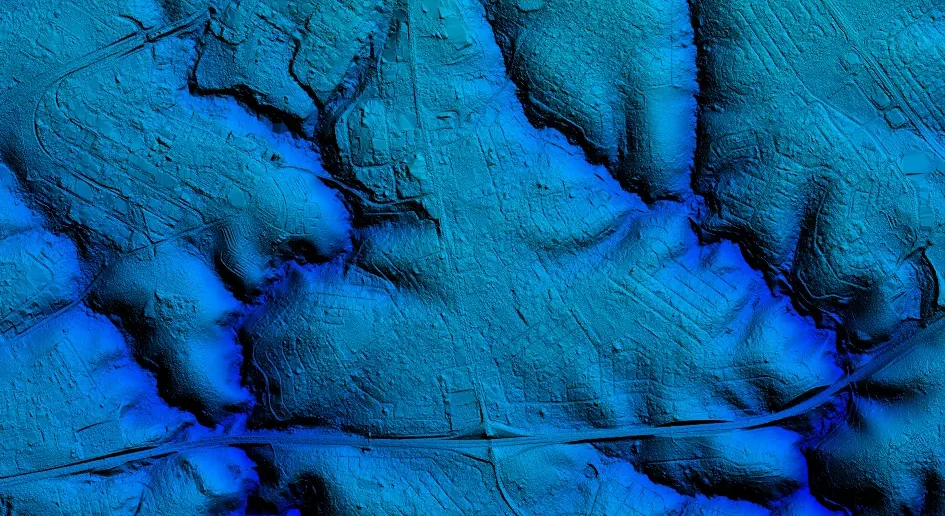
Figure 7. Final 2-meter DTM product (Source: Hexagon)