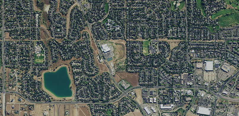
More than 30,000 Colorado residents were driven from their homes last Thursday as a series of wildfires spread rapidly across Louisville, Superior, and Boulder County. Worsened by over 100-mph winds, the fires sprawled over 9.4 square miles, destroying over 1000 homes and buildings in the suburban community.
Hexagon is offering free access to its 2021 pre-disaster aerial imagery of Colorado to all federal and state agencies and non-profit organizations involved in the relief and remediation efforts of the Marshall fire. The imagery is delivered via on-demand streaming at no cost through the HxGN Content Program to assist in making critical decisions that impact the wellbeing of those affected.
Pre-disaster aerial imagery can be used in many ways to respond to a natural disaster or crisis:
- Create baseline maps to compare with imagery acquired after an event;
- Prioritize mitigation and preparedness activities in the area;
- Pinpoint potential hazards, such as areas at risk of flooding, potential landslides, and dangerous zones;
- Identify access and evacuation routes;
- Discern wildlife in the affected area;
- Determine areas or zones that need to be prioritized;
- Identify built-up urban areas.
The Content Program’s high-resolution aerial imagery is orthorectified and cloud-free, hence a reliable resource for first responders and organizations to confidently assess damages, visualize needs, plan coordination efforts, and improve response.
Please contact us at [email protected] to start streaming Colorado’s 2021 aerial imagery.


